1940s Atlas
Posted: Sat Nov 21, 2020 2:15 am
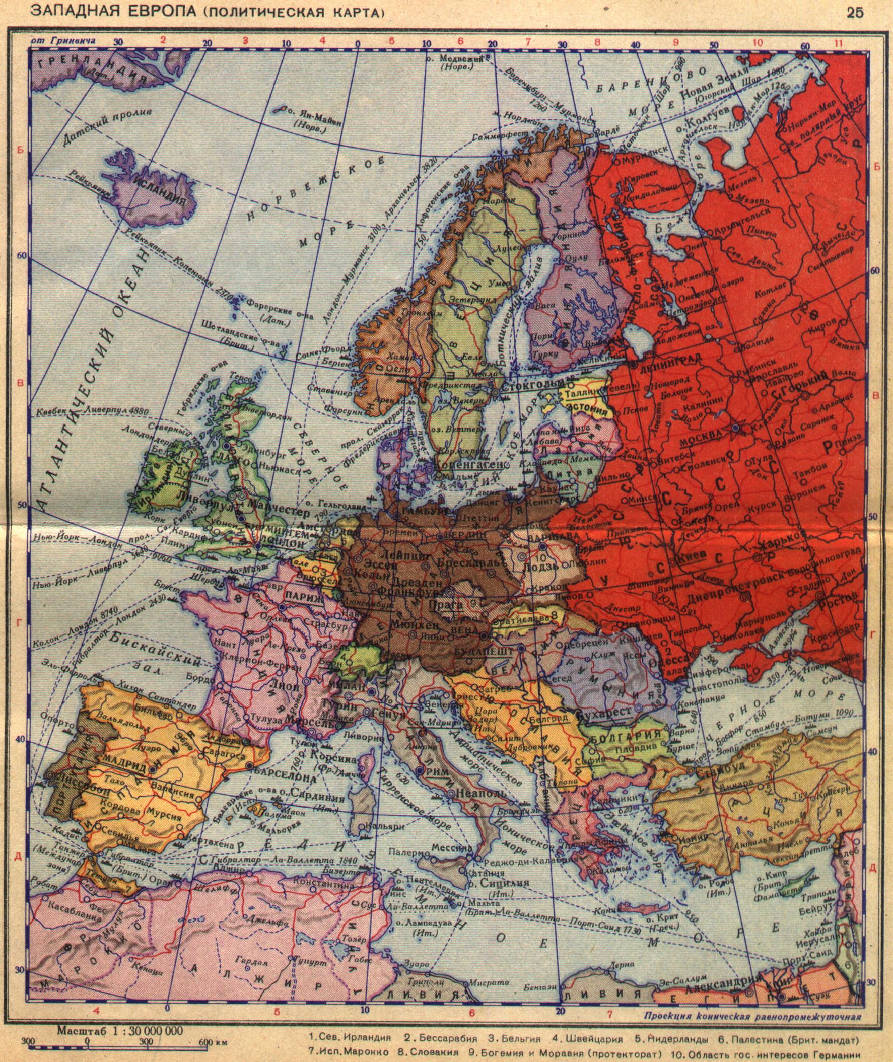
Anybody have any idea how to get a mid-20th century road atlas of Germany or Italy or both on line?
I would really like to have a Michelin or Google-earth style map of them. I think other developers would like to have 1940s or even 1950s detail maps of France, Belgium, Balkans, Baltic states, Byelorussia, etc etc. The published battle maps only show a couple of major towns and some important crossroads where an engagement may have happened.
But they don't serve the purpose for recreating the available routes, population centers, etc of WWII.
The maps we can find now are like trying to use a recent map of Florida to explain the ground situation in 1949 before they eliminated free-range cattle farming...
conboy
Here's one for Italy that I just discovered after I posted.
http://www.custermen.com/Maps/ArmyMaps.htm
I guess I didn't look hard enough...
https://legacy.lib.utexas.edu/maps/ams/italy_250k/